Our own ‘astronaut’ in space? PH eyes having new Earth Observation satellite in space by 2023
Imagine, in two years’ time, the Philippines might have its very own “astronaut” in outer space – how cool is that?
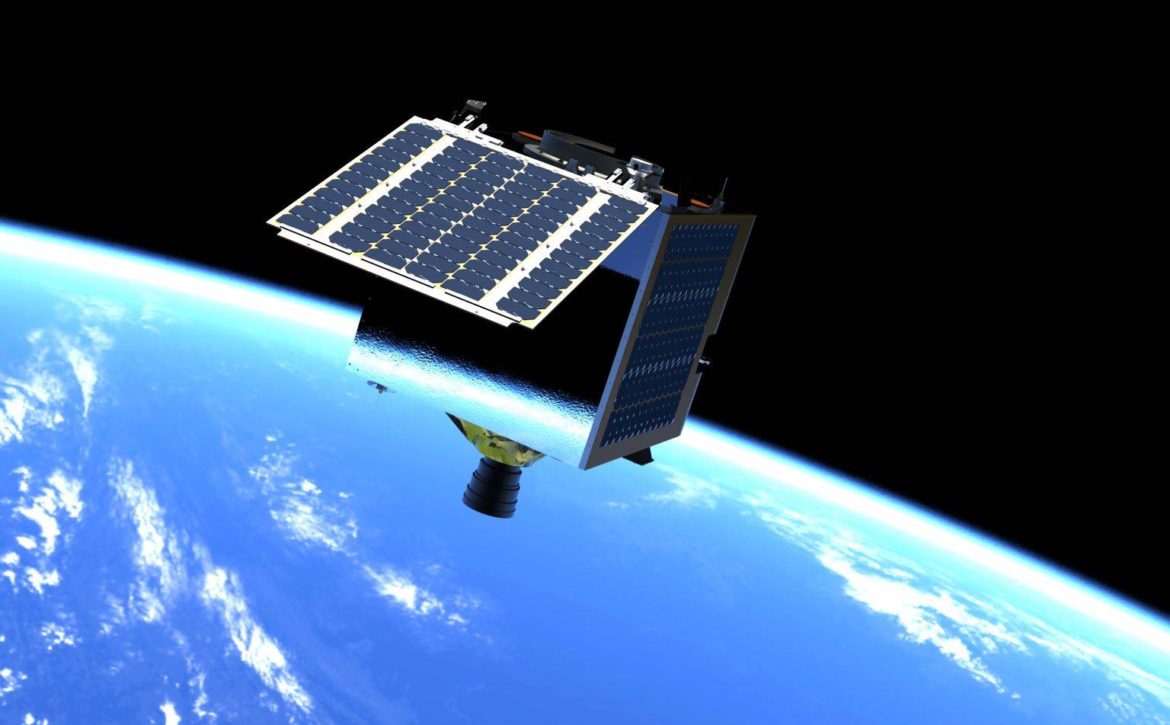
3D renders of the MULA satellite. (Photo courtesy of SSTL2 / Fortunato de la Peña / FB)
By 2023, the Philippines hopes to have a new Earth Observation satellite in space as the country gears up for a next generation of satellites.
Department of Science and Technology (DOST) Secretary Fortunato de la Peña, in a Facebook post on Thursday, June 10, announced this – noting that the DOST, through its Advanced Science and Technology Institute (DOST-ASTI) – has been spearheading various initiatives that helped build a “strong foundation” for such endeavor.
“Indeed, we have come a long way since the launching of the Diwata-1 microsatellite to the International Space Station (ISS) in 2016, but there is still a lot of work to be done,” de la Peña said.
However, he also noted that “we have just started.” De la Peña explained that after sustaining the gains from the Philippines’ microsatellites DIWATA-1 and DIWATA-2, “plans are underway to have a bigger Earth Observation satellite that can capture operational-quality – images of approximately 100,000 km2 of land area daily.”
PH’s ‘biggest’ satellite
Dubbed the Multispectral Unit for Land Assessment or MULA, de la Peña said that the commercial-grade satellite will weigh 130kg and will be the country’s “biggest” – to date.
3D renders of the MULA satellite. (Photo courtesy of SSTL2 / Fortunato de la Peña / FB)
De la Peña said that the newest satellite initiative – which is funded the DOST – is currently being developed by the Advanced Satellite and Know-how Transfer for the Philippines (ASP) Project.
This initiative, de la Peña explained, is being done “as part of the science agency’s priority agenda under the emerging technologies sector of providing space technology applications to public services.” De la Peña said that the project is implemented by the University of the Philippines Diliman (UP Diliman) and the DOST-ASTI.
The initiative is also in coordination with the Philippine Space Agency (PhilSA) which will be responsible in overseeing its completion.
PhilSA, de la Peña said, will also oversee the project until its expected launch by 2023 – as well its “management and operation thereafter.”
De la Peña explained that the project is being designed and manufactured together with British company Surrey Space Technology Ltd (SSTL).
SSTL, he added, is one of the leading providers of small satellite development and know-how-transfer.
“The new satellite, MULA, will carry a TrueColor camera capable of capturing 5m resolution images with a wide swath width of 120km,” de la Peña explained. “It will have 9 spectral bands that can be used for different environmental applications such as disaster management, land use and land cover change mapping, crop monitoring, and forestry management,” he added.
De la Peña said that TrueColour was derived from SSTL’s Disaster Monitoring Constellation (DMC) satellite.
Citing SSTL Managing Director Phil Brownnett in a press release, De la Peña said that incorporating it into MULA’s 130-kg-mass category will be “a new benchmark for Earth Observation capabilities at this mass and price point.”
Star Tracker Testing in the Test Lab. (Photo courtesy of SSTL2 / Fortunato de la Peña / FB)
De la Peña explained that the new satellite will also be equipped with two other payloads: Automatic Identification System (AIS) and Automatic Dependent Surveillance-Broadcast (ADS-B), which can be utilized for ship and aircraft detection and tracking.
“The preliminary mission objectives of the satellite were determined based on a needs assessment conducted by the ASP Project of the Space Technology Applications Mastery, Innovation and Advancement (STAMINA4Space) with various stakeholders in the Philippines during the first quarter of 2020,” De la Peña said.
Meanwhile, PhilSA Deputy Director-General and ASP Project Leader Dr. Gay Jane Perez explained that MULA’s capability to capture higher resolution images will “enable us to better monitor terrestrial ecosystems, as well as our land and marine resources to ensure both agricultural productivity and environmental integrity.”
Perez added that “we will also be able to assess environmental conditions to be more proactive in disaster management and mitigation.”
Our very own ‘astronaut’
MULA Project Manager Engr. John Leur Labrador said that the planned multispectral imager calibrated for land assessment can be thought of as “having our own ‘astronaut’ in space.”
“We can think of this spacecraft as a Filipino astronaut tasked to take images of our natural resources while monitoring aircraft and ship activity in our country at the same time,” Labrador said.
“We aim to significantly increase the land area captured by this satellite compared to our previous ones, effectively increasing the information gathered from the produced images,” Labrador added.
Inspiring the next generation of Filipino scientists
Meanwhile, De la Peña could not help but beam with pride with various recent developments in space research.
“The advancement of space research and development in the Philippines has always been part of the DOST’s priority goals, so the creation of the PhilSA during my service as DOST Secretary is something that I will always be proud of,” De la Peña said.
De la Peña added that more than the building of infrastructures and creation of micro-satellites, there is a greater and more urgent need to train young Filipino engineers.
“It is very crucial for us to build a competent pool of human resources who will train and inspire the next generation of Filipino scientific minds,” De la Peña ended.
Read More


